West Branch State Park Mountain Bike Trail
About This Trail
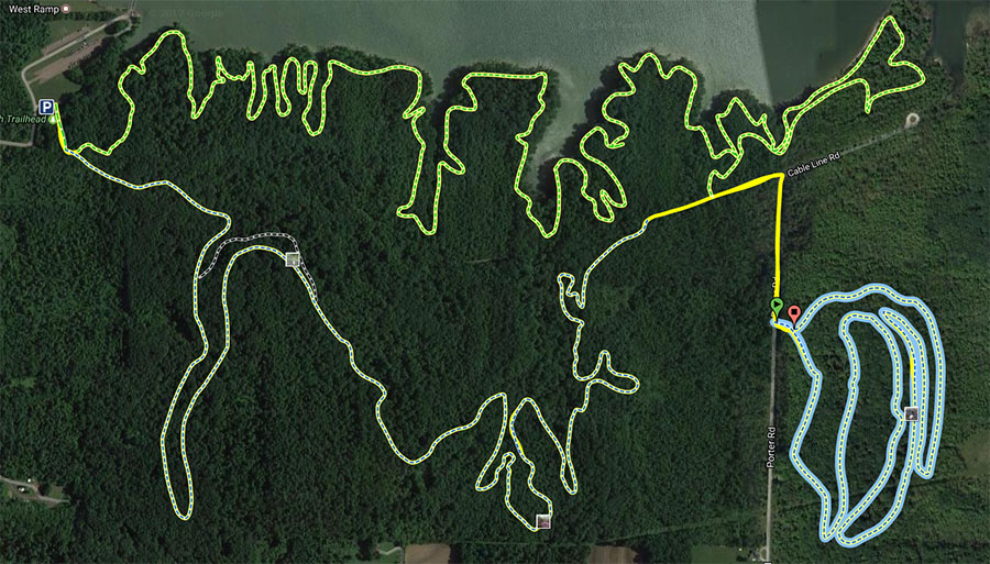
The state park is located in the city of Ravenna with in Portage County. Most of the trails here actually started out as snowmobile trails but soon accommodated mountain bikes in the summer as the sport grew. There are two additional single-track loops added as of summer 2001 adjacent to loops “B” and “D.” With the help of CAMBA, these two loops and many more miles of single-track are predicted for the future.
Closed seasonally from March 1st to through the third weekend of May to give the trails time to dry. This is marked at the trailhead and the trails would be nearly impossible to ride with any bike because the high clay mud sticks to everything. The rest of the year the trail may be closed after rain until the trail once again has time to dry out.
The trails are also closed during the hunting seasons, so be sure to check for this if you are headed out in the fall or winter.
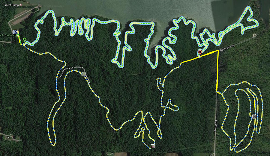
There are nice lake views and smooth singletrack on the Lakeside Trail. This is a good trail for beginners and intermediate riders and is a good warm up for some of the other trails.
The Quarry Trail seriously ups the difficulty with some really rough ground. A lot of rock gardens and generally rocky terrain make this with out a doubt an expert trail. Please do not under estimate to difficulty of the the Quarry Trail. Pleasealso be aware that yellow jackets love making nests in the rocks. Be prepared for an encounter with this lovely little guys at any point in the rocky sections.
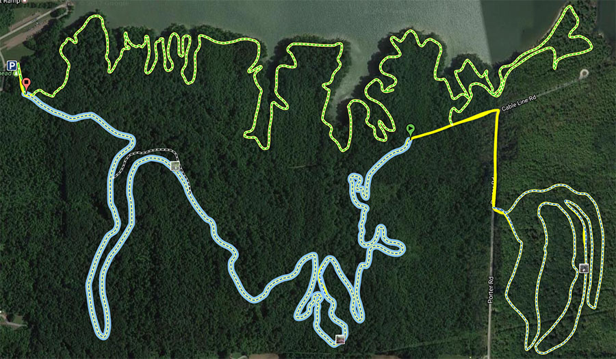
The Southside Trail is a mixture of all of this and really rounds out a ride. This trail is generally intermediate to advanced with only a section or 2 that will really challenge. The creek crossing will catch new riders to the area by suprise. Ride it more than once and you figure it out. Again, this area is closed due to rain longer than other areas in the region so please pay attention to recent rainfall and season.
Location and Directions
Directions (from Akron/Canton): I-77 South to I-76 east- exit at Rt.5/44 proceed on Rt.5 east to Rock Spring Rd. Turn right onto Rock Spring Rd. See Below **
Directions (from Cleveland): Take I-480 East. I-480 E becomes OH-14. Turn LEFT onto OH-59. OH-59 becomes OH-5 East. Look for Rock Spring Road on your right, it will be several miles down. Turn right onto Rock Spring Road.
** Follow Rock Spring Road across the reservoir. Less than 1/2 mile after crossing the reservoir, you will see signs for the mountain bike/snowmobile trails on the left side. Follow the road about 1/4 mile and you'll see a grass field on your right with a small gravel parking area. You'll see the trailhead sign along the tree line. Please do not park on the grass unless there are no spaces available on the gravel.
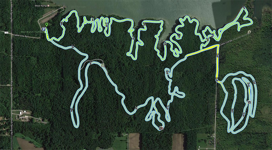
Trail Map
To view any of these maps interactively visit: https://www.mtbproject.com/trail/4005069/west-branch-state-park-full-tour
West Branch State Park Mountain Bike Trail Overview Map
