Cleveland Metroparks Royalview Single Track Mountain Bike Trail
About This Trail
The Royalview Trail is located in the Mill Stream Run Reservation of the Cleveland Metroparks near Strongsville, Ohio. It was first opened in June of 2012, after many hours of design and construction work by the Cleveland Metroparks and volunteers from the Student Conservation Association and the Cleveland Area Mountain Bike Association (CAMBA).
The trail network consists of two loop trails:
- The Yellow Trail - about 3.5 miles
- The Red Trail - about 5.5 miles
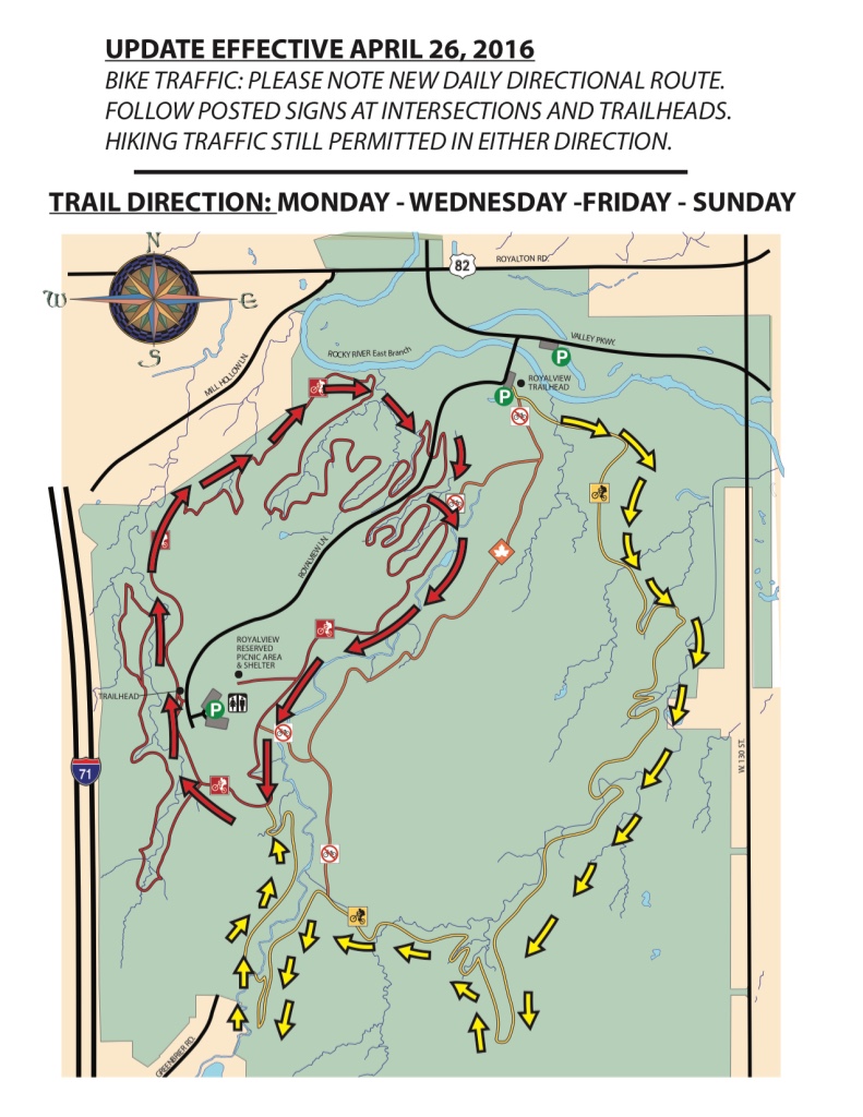
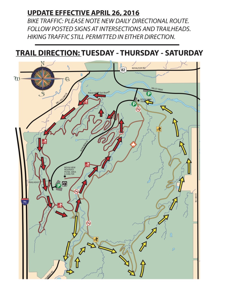
Both trails are one-way for mountain bikers; ride the Yellow Trail clockwise and the Red Trail counter-clockwise. The trails are open to hikers in either direction, so be courteous and follow the rules for shared trails.
UPDATE - TRAIL DIRECTION HAS CHANGED. THE TRAIL CAN NOW BE RIDDEN BOTH DIRECTIONS DEPENDING UPON THE DAY OF THE WEEK. PLEASE BE SURE TO CHECK THE TRAIL MAP AT THE TRAIL HEAD TO SEE WHICH DIRECTION YOU SHOULD BE RIDING THE TRAIL ON THAT DAY.
PLEASE SEE UPDATED ROYALVIEW SINGLE TRACK DIRECTIONAL TRAIL MAPS BELOW
The terrain is beginner-to-intermediate-level, with gentle climbs and descents, and some roots and rocks.
Go to @CMPmtb on Twitter to check the latest trail open/closed status.
Location and Directions
- Take Interstate 71 to State Route 82.
- Turn East on State Route 82.
- Turn RIGHT onto Valley Parkway.
- Turn at the first RIGHT onto Royalview Lane.
There is a small parking area immediately on the left on Royalview Lane. You can park here and start riding on the Yellow Trail. You can connect to the Red Trail, or follow the yellow arrows along a short section of Royalview Lane to return to the parking area.
There is another parking lot at the end of Royalview Lane by the reserved picnic shelter. You can park here and start riding on the Red Trail, and then connect to the Yellow Trail.
Trail Map


