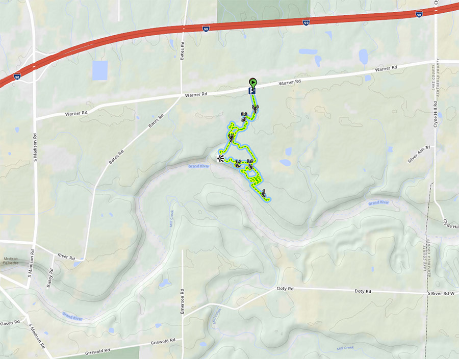
Atchinson / Hogsback Ridge Lake Metroparks Mountain Bike Trail
About The Trail
This is the only trail network on the north east side of Cleveland. (West Branch is over an hour and 15 mins from here). Yes it's a short loop but it's got its charm and we are working with the land manager to improve this network and possibly get access to more property closer to civilization.
There are a few very well built bridges in this park and the switchback section is a blast to ride in both directions. Keep an eye out for updates as we address problem areas for some reroutes to this trail network. You can get a good 60 minute 8-mile ride in here if you are willing to reverse direction and ride a loop 3-4 times.
Location and Directions
From Cleveland, take I-90 East out of town, past 44, past Vrooman road, to 528. There's a water tower with horses around it and a McDonald's. Make a right. Turn left at the next road - there's a Marathon gas station at the corner. Go down the road about a mile. You will pass Bates Road. Trail comes up about a half mile after Bates Rd. across the street from a gas well. Park in the gravel parking area.
In case this lot is full (The lot only holds about 8 cars...) you will need to park back at Riverview Park. To find Riverview Park, head back west to Bates Rd. turn left on Bates and stay on it until it ends into River Rd. Turn right on River Rd. and travel a short distance to Bailey Rd. and turn left on Bailey and head into the parking lot at Riverview Park on your left. Parking here will give you a nice 1.7 mile warm-up road ride to Atchinson!
Trail Map